The Best Day Hikes in Tekapo
Lake Tekapo township is emerging as one of the great adventure capitals of New Zealand, and it’s easy to see why. Tekapo is surrounded by world-class freshwater fishing, lakes for water sports, mountains for skiing, and of course, some of New Zealand’s best hiking and biking trails (tap here to see our top 8 best outdoor activities in Tekapo!)
So weather you’re an avid hiker, or you’re looking to stretch the legs after a day’s skiing at Round Hill Ski Area, stretch the legs after a long car journey, get the blood flowing before relaxing at the Tekapo Springs Hot Pools, or warm the legs up before embarking on one of our Mackenzie District Hut to Hut Hiking Tours – look no further, here’s a list of our top 6 hikes in Tekapo.
The best day hikes in Tekapo are:
- Mount John Summit Track
- The Richmond Trail
- Alpine Tarns & Cass Valley Landscapes
- Cowan’s Hill Walkway
- Lake George Scott Track
- Lake Alexandrina Walks
Tekapo Day Hikes Map
Before You Hike: Tekapo Weather Forecasts
1. Mount John Summit Track
Hiking Time (from Tekapo Springs): 1.5 hours
Hiking Time (from Lake Tekapo Township): 3 Hours
Grade: Easy
Dog Access: Dogs are not allowed.
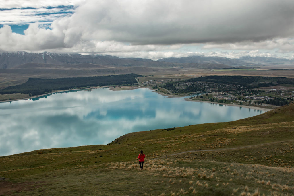
With its proximity to the Lake Tekapo township and easy trail rating, the Mt John hike is the most popular hike in Tekapo.
This 1.5-hour hike makes its way from the Tekapo Springs Hot Pools on the south side of town, up to the Mount John Observatory, and back alongside the lake to the starting point.
If you want to shoot to the South Summit of Mount John, you’ll start at the same location and the summit is a 45 minute walk each way.
Along the way you’ll get panoramic views of the Richmond Range, Lake Tekapo, the surrounding Lake Tekapo Township and the wider Mackenzie Country.
The track is dual purpose, so mountain bikes are allowed and riding the circuit will take approximately 1 hour.
Another way to enjoy Mount John is to drive to the summit, walk the circuit track and enjoy a hot coffee at Astro café in the observatory afterwards.
2. Richmond Trail
Starting Location: Round Hill Ski Area
Hiking Distance: 13-kilometres one-way
Hiking Difficulty: Easy
Dog Access: Dogs are not allowed
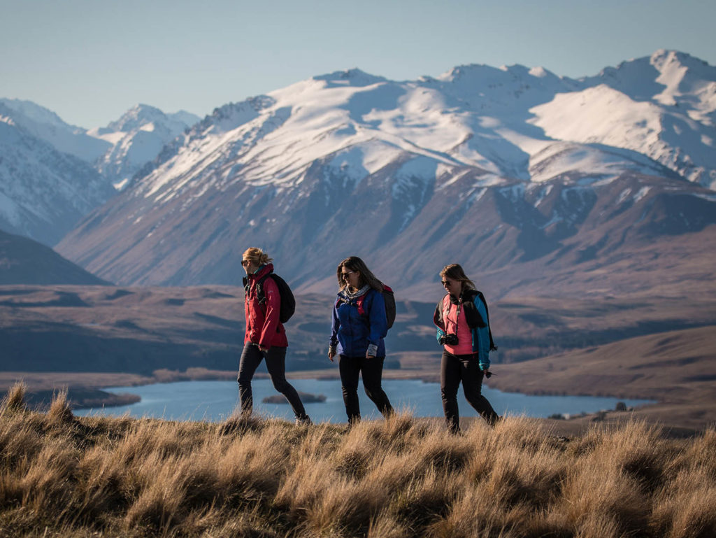
Image Source: Mackenzienz.com
If you’re looking to get off the beaten track and explore one of New Zealand’s most hidden gems of hiking trails, the Richmond Trail is a must-do. Many travellers between Christchurch and the Southern Lakes use the Richmond Trail as a midway point of their journey, the perfect way to break the journey by stretching the legs and pulling off the great hike.
Hiking the Richmond Trail is 13-kilometers one way. The starting point for the trail is clearly signposted on the right-hand side of the road, just as you arrive at the lower car park of the Round Hill Ski Area. The trail then traverses across the glacier-cut range, and the final decent from the trail takes you down to Boundary Stream Car Park.
The Richmond Trail is a dual-purpose trail, and while mountain bikes are allowed there’s plenty of visibility and no chance of anyone bumping into each other. The best place for mountain bikers to begin the journey is at the Boundary Stream car park. Bike up the road, on to the trail and do the full loop.
Some hikers begin at the Boundary Stream car park too, but the most common option is to take 2 vehicles, park one at Boundary Stream then drive the other to the trailhead.
Hikers will take 4-5 hours to complete the trail, and mountain bikers will take between 2 and 3 hours to complete.
The Richmond Trail is a true wilderness experience, and for any advice or guidance on the journey you can contact the team here at Tekapo Adventures.
3. Alpine Tarns & Cass Valley Landscapes
Starting Location: Glenmore Station (private access via tekapo adventures)
Hiking Distance: Between 3-1-kilometres depending on route
Hiking Difficulty: Easy
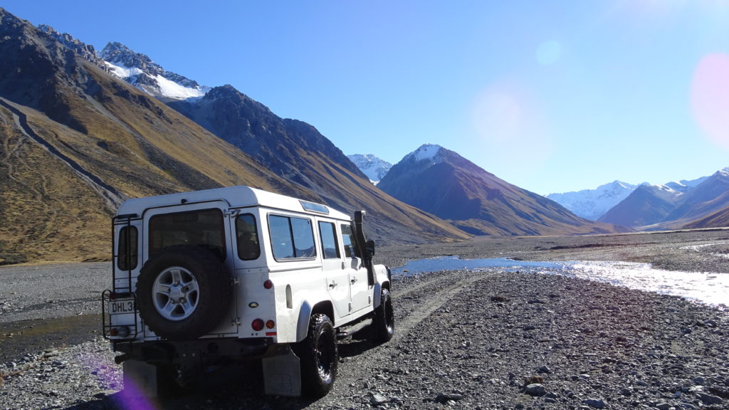
For a beautiful and stunning alternate view of Lake Tekapo from the Western knolls and high country, join us to access the private landscapes from the impressive high country terrain of Glenmore Station. Join our local guides and hop on board our Ranger Rover Discoveries to start the hike with a short 15-minute 4WD adventure.
Along the hike you’ll enjoy a gentle climb via Merino sheep single track, to reveal expansive views over many alpine lakes, tarns and grandiose mountain and glacier views. Follow our gentle routes of Merino-made hoof trails, to the glistening tussock grasslands, roaming merinos, big skies and towering maintain vistas.
You’ll take in beautiful views of the Cass River (one of New Zealand’s hidden gems) as it winds its way into Lake Tekapo, while being set on a backdrop of the towering peaks of the Cass Valley backcountry.
The Cass Valley is a wonderful Lake Tekapo hiking experience, capturing such dramatic Mackenzie Country vistas within a such short distance from Tekapo township.
Contact us: info@tekapoadventures.com
4. Cowans Hill Walkway
Starting Location: Bridge at State Highway 8 near the Church of the Shepard
Hiking Distance: 3.2-kilometres one-way
Hiking Difficulty: Easy
Dog Access: Dogs are allowed on a leash
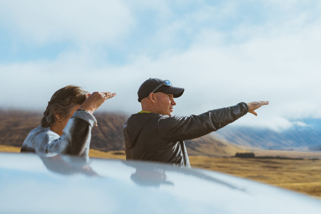
Learn about the rich history and geology of New Zealand’s impressive High Country on our small group Tekapo Hiking Tours.
If you’re looking for a short walk in Tekapo, then the Cowan’s Hill Walkway and Lake George Scott Track is a really nice way to explore the local architecture, and hike to a view point overlooking Lake Tekapo.
Both of these walks start at the bridge where State Highway 8 crosses the Tekapo River, on the Northern end of town. The Cowan’s Hill Walkway starts on the North side of the bridge and heads east away from the Lake. As you walk alongside the Tekapo River you’ll be treated to the opaque blue glacier—fed waters which are so iconic to the Mackenzie District. Follow the trail across Refuse Tip Road and follow the trail markers through the forest and into the grasslands.
The Cowan’s Hill track is approximately 3.2-kilometers to walk, and you’ll get to explore the urban side of Lake Tekapo. This town really is booming, so enjoy the architecture that uniquely sympathises the surrounding alpine environment.
Both bikes and dogs are allowed on the Cowan Hill track. The track is an out-and-back hike, and the grade is easy.
5. Lake George Scott Track
Starting Location: Bridge at State Highway 8 near the Church of the Shepard
Hiking Distance: Between 3 and 10-kilometres, depending on route
Hiking Difficulty: Easy
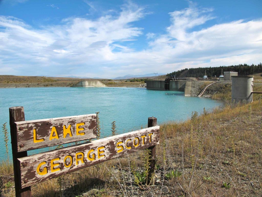
Image Source: nzfrenzysouth.wordpress.com
For a nice little extension to the Cowan Hill track, hop across bridge at State Highway 8 and you’ll find the Lake George Scott Track, which starts right across the river from the Cowan Hill track.
The Lake Georges Scott walkway is around 3-kilometeres each way (if you do the out-and-back option) and leads to Lake George Scott which is a man-made lake designed to feed one of Tekapo’s hydro-electric stations.
When you begin the hike, you’ll follow the marked trail up a steep hill, before descending onto the Lake Tekapo River flats. Along the way you’ll meander through a stunning pine forest and get stunning views of the Tekapo River.
If you prefer to do a loop hike, follow the track through the pine forest to the boundary fence, where you’ll get elevated views of the surrounding Tekapo township and Lakefront. This route will reconnect with the original track which leads back to the bridge, so you’ll get an entirely new perspective of the trail as you’ll be treated to stunning views.
6. Lake Alexandrina Walks
Starting Location: Lake Alexandrina Campground
Hiking Distance: Up to 3 kilometres, depending on route
Hiking Difficulty: Easy
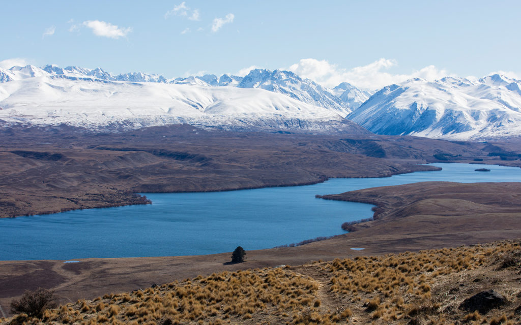
Image Source: Mackenzienz.com
Located just a 15-minute drive from Lake Tekapo Township (via Godley Peaks Road and Lake Alexandrina Road) Lake Alexandrina is popular stop for hikers, bikers, and anglers alike.
The best place to start your day hike is to park your car at the Lake Alexandrina Campground. From there you have the option of a nice lakeside walk that takes you along the lakefront of the campground. This is perfect for a gentle stroll, but the most popular walk at Lake Alexandrina is to cross the small bridge on the south side of the campground carpark and walk along the lakeside, near the holiday homes.
For those keen photographers, Lake Alexandrina is one of the best places in Tekapo to experience Lupins in full bloom. Take your camera to capture the striking yellows, purples and greens set on a backdrop of snow-capped mountains.
Ready to explore Tekapo’s backcountry?
CLICK HERE or the image below to discover our Mackenzie Alpine Hiking Tour today.
- Small groups
- Local guides
- Exclusive private access


